
File:Antarctica map.jpg
Size of this preview: 686 × 599 pixels. Other resolutions: 275 × 240 pixels | 550 × 480 pixels | 879 × 768 pixels | 1,173 × 1,024 pixels | 2,345 × 2,048 pixels | 4,549 × 3,973 pixels.
Original file (4,549 × 3,973 pixels, file size: 6.18 MB, MIME type: image/jpeg)
Captions
Captions
Add a one-line explanation of what this file represents
| Warning | The original file is very high-resolution. It might not load properly or could cause your browser to freeze when opened at full size. |
|---|
| Publisher |
Justus Perthes |
||||
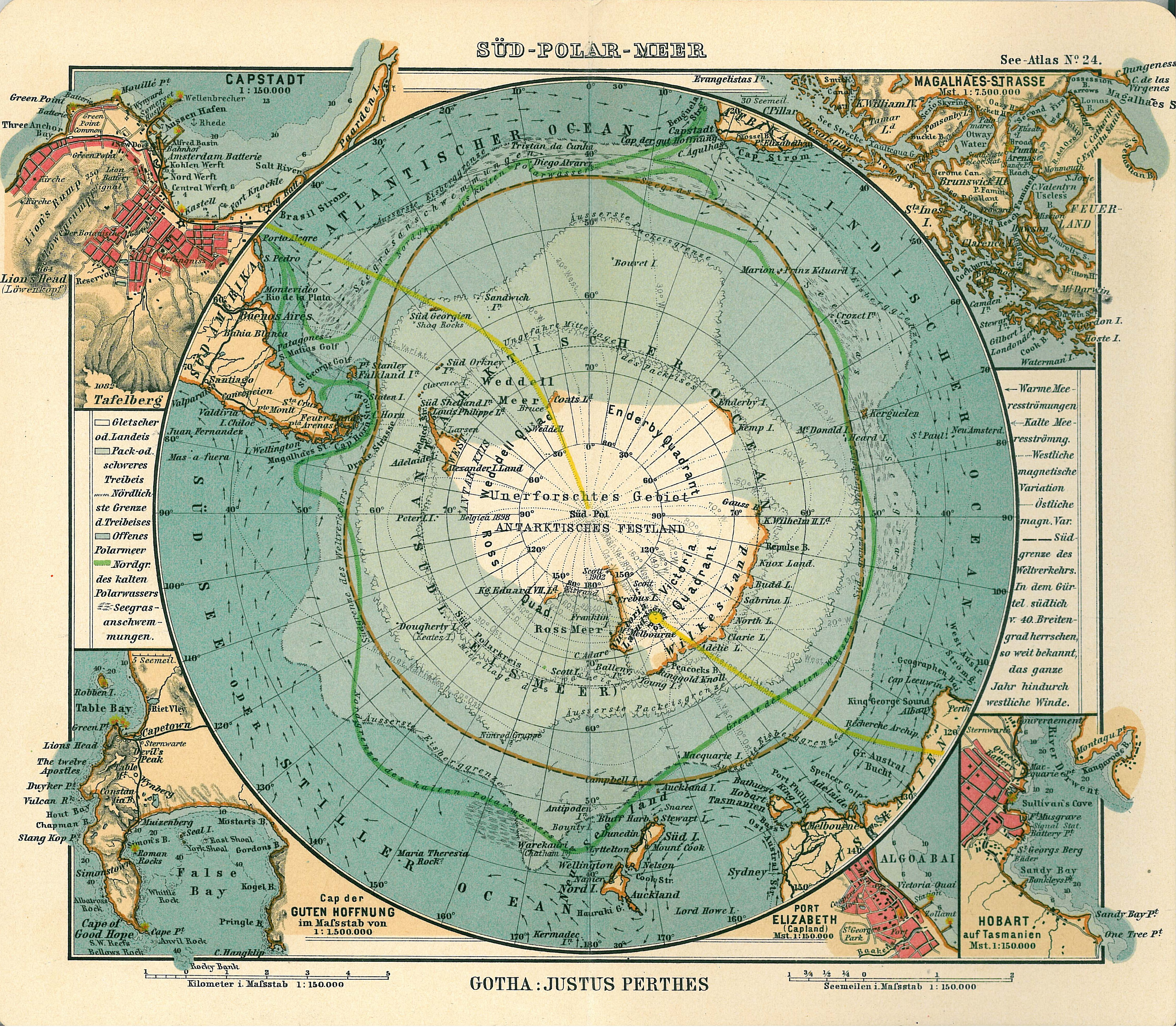
| Description |
Deutsch: Blatt 24, Süd-Polar-Meer
English: Page 24, Antarctica, Inset maps of Cape town, Cape of good hope, Magalhaes strait, Hobart, Port Elizabeth |
||||
| Publication date | 1906 | ||||
| Place of publication | Gotha | ||||
| Source | See Atlas | ||||
| Permission (Reusing this file) |
|
||||
.jpg)
File history
Click on a date/time to view the file as it appeared at that time.
| Date/Time | Thumbnail | Dimensions | User | Comment | |
|---|---|---|---|---|---|
| current | 17:08, 15 January 2007 | | 4,549 × 3,973 (6.18 MB) | Martas011 (talk | contribs) | Category:Old maps of Antarctica Category:Maps of oceans Category:Maps of the Southern Ocean Good map of Antarctica, Justhus Perthes See Atlas 1906 Inset maps of Cape town, Cape of good hope, Magalhaes strait, Hobart, Port Elizabeth |
You cannot overwrite this file.
File usage on Commons
The following 4 pages use this file:
File usage on other wikis
The following other wikis use this file:
- Usage on avk.wikipedia.org
- Usage on ca.wikipedia.org
- Usage on de.wikipedia.org
- Usage on en.wikipedia.org
- Usage on eo.wikipedia.org
- Usage on id.wikipedia.org
- Usage on it.wikipedia.org
- Usage on ja.wikipedia.org
- Usage on ko.wikipedia.org
- Usage on nl.wikipedia.org
- Usage on pl.wikipedia.org
- Usage on pt.wikipedia.org
- Usage on ru.wikipedia.org
- Usage on zh.wikipedia.org